


Delivery Time
Inside Dhaka: From next day to 1 business days.
*Inside Dhaka North and South City Corporation.
Outside Dhaka: From next day to 3 business days.
**Home Delivery/Courier Delivery.
Shipping Charge
Inside Dhaka: Starts from 100Tk.
**Inside Dhaka North and South City Corporation.
Outside Dhaka: Starts from 200Tk.
**Home Delivery/Courier Delivery.

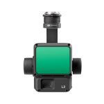
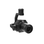
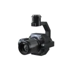
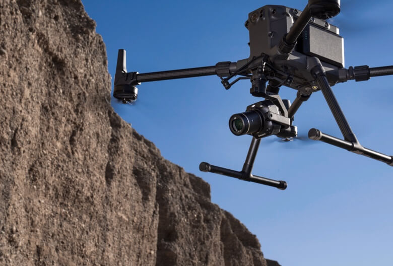
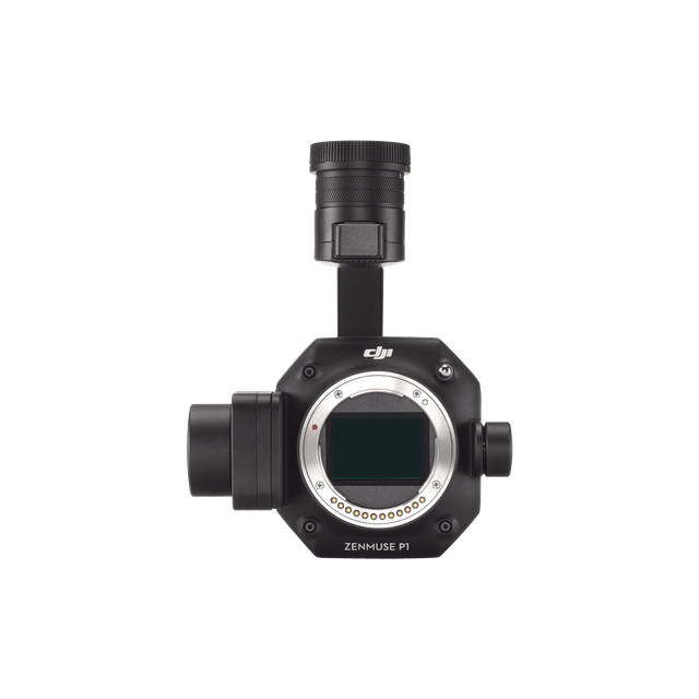
The New Benchmark for Aerial Surveying
The Zenmuse P1 integrates a full-frame sensor with interchangeable fixed-focus lenses on a 3-axis stabilised gimbal. Designed for photogrammetry flight missions, it takes efficiency and accuracy to a whole new level.


Efficiency to Cover It All
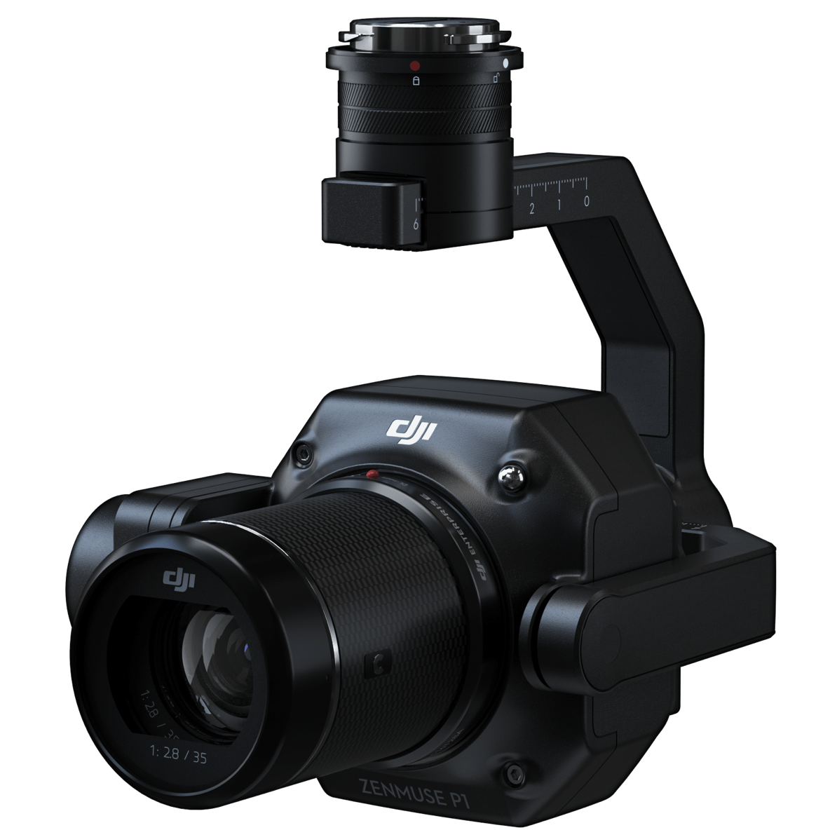
Full-frame Camera
– 45MP Full-frame Sensor
– 4.4μm Pixel Size
– Low-noise, high sensitivity imaging extends daily operational time
– Take a photo every 0.7 s during the flight
– TimeSync 2.0 aligns the camera, flight controller, RTK module, and gimbal at the microsecond level
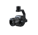
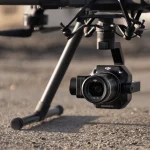
Flexibility to Capture It All
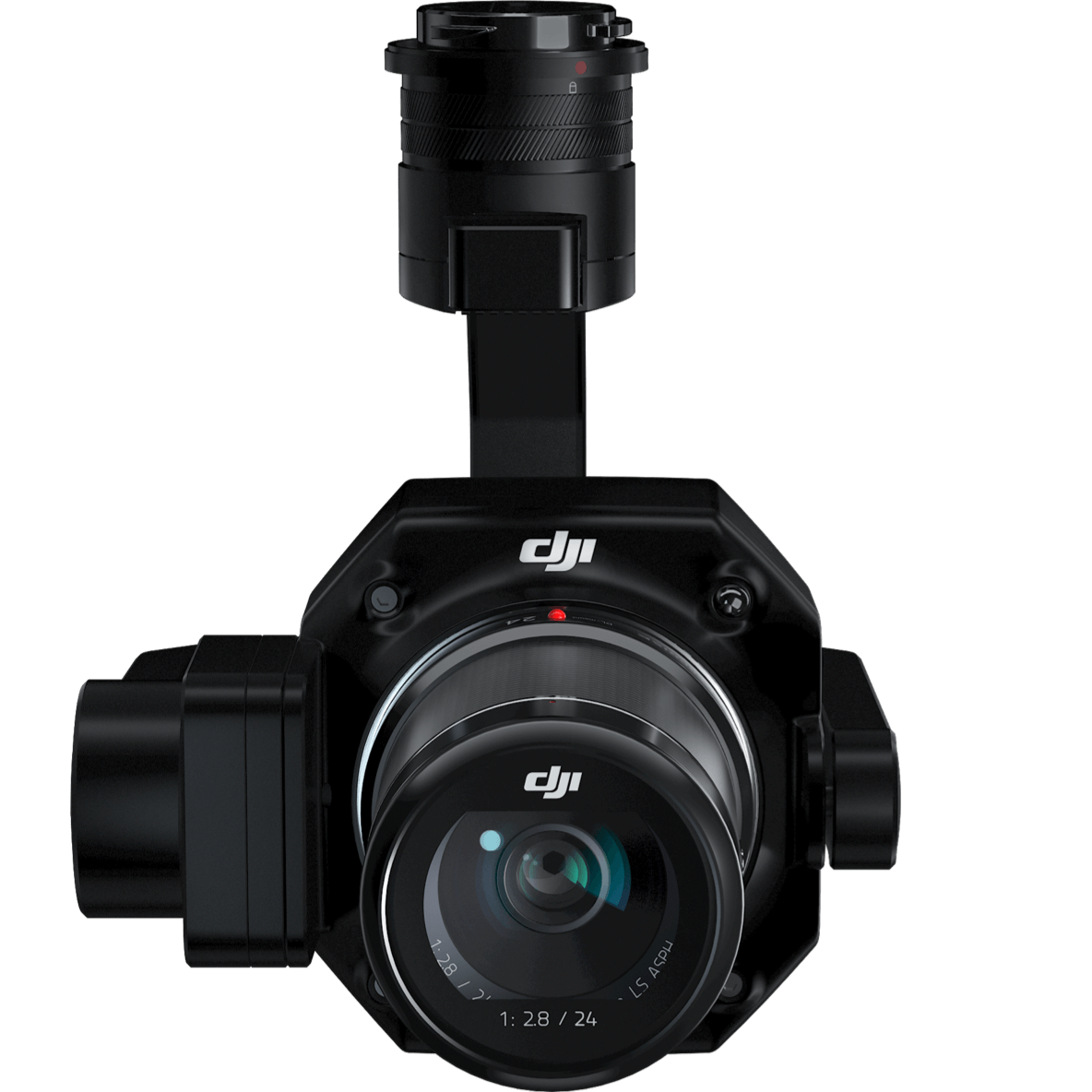
Multiple Fixed-focus Lens Options
– Global Mechanical Shutter, , Shutter Speed 1/2000 Seconds
– Sends the median exposure pulse in microseconds
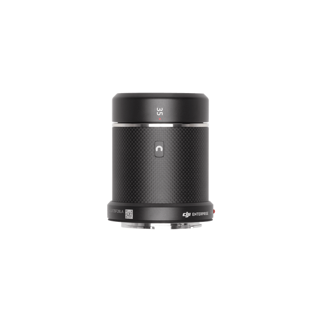
– Supports 24/35/50mm lenses with DJI DL mounts
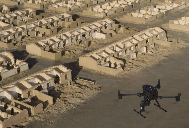
Smart Oblique Capture
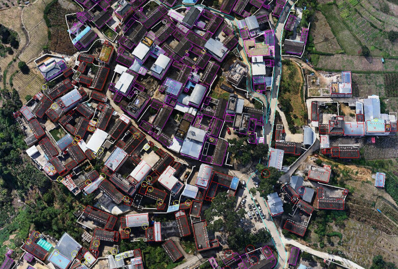
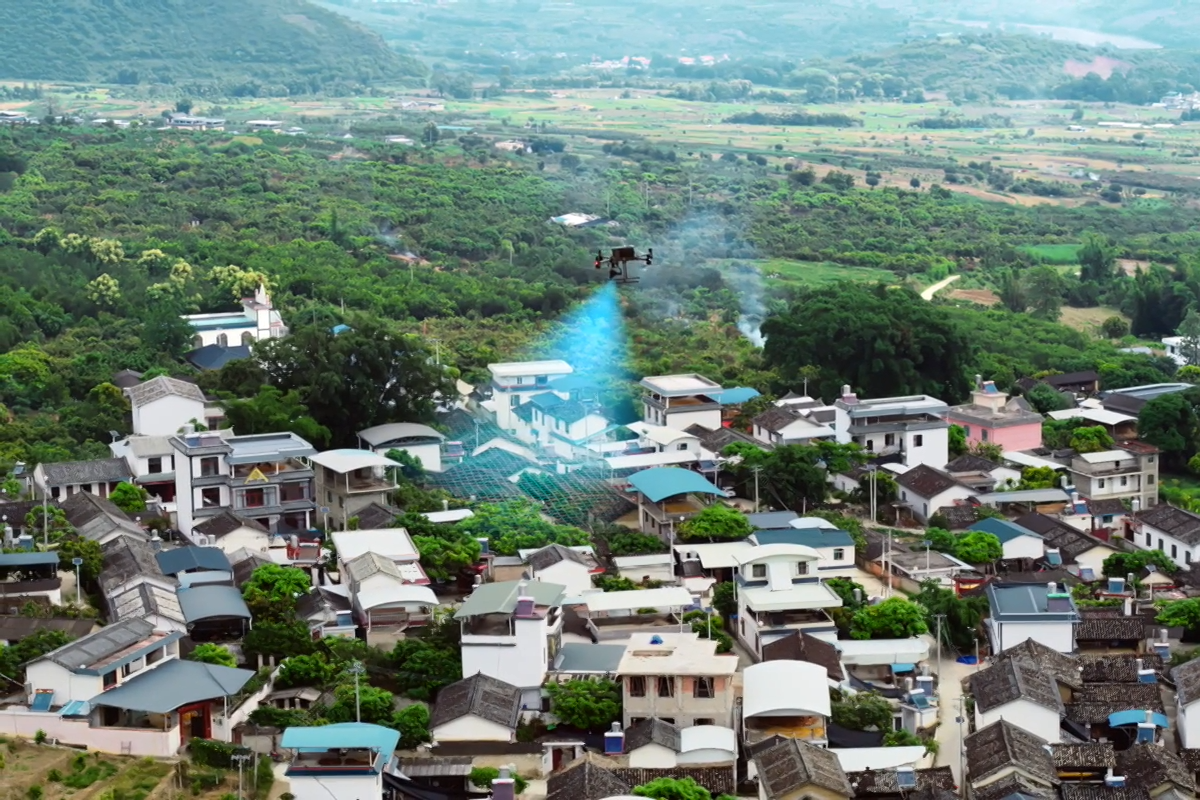
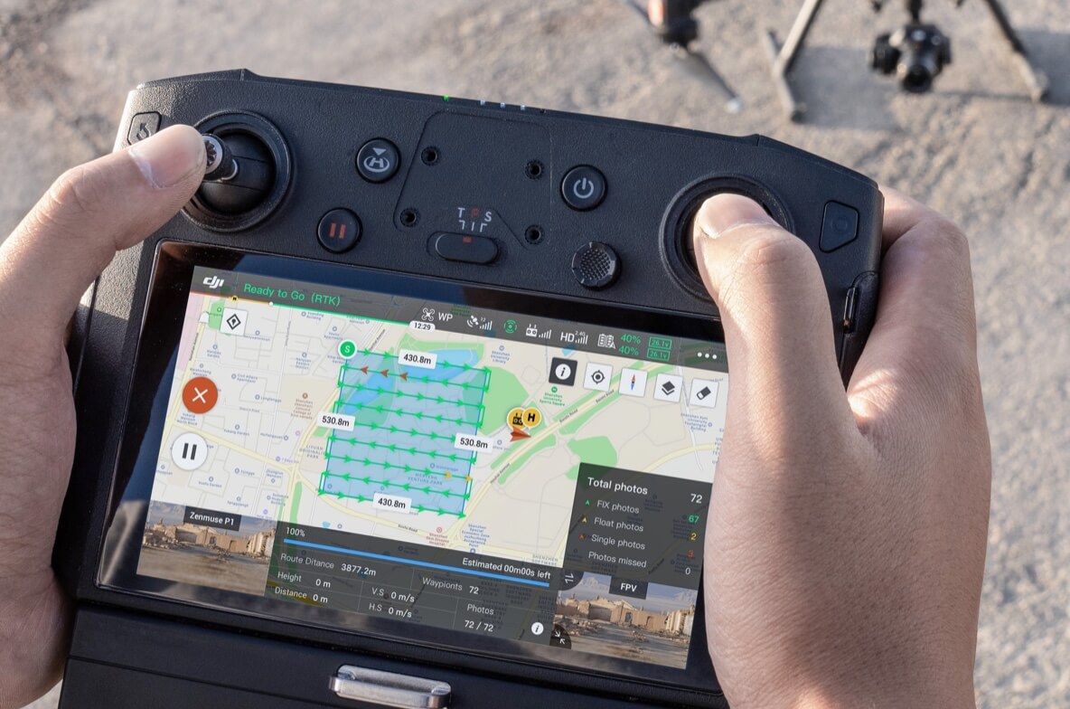
Cover 7.5 km2 in a single workday with the P1. Elevate the efficiency of your oblique photography mission using Smart Oblique Capture, where the gimbal automatically rotates to take photos at the different angles needed. Only photos essential to the reconstruction will be taken at the edge of the flight area, increasing the efficiency of post processing by 20% to 50%.
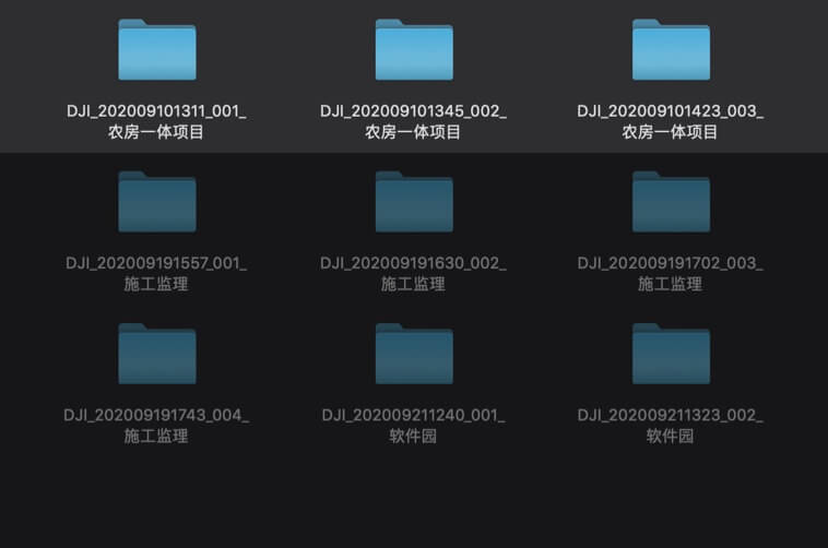
Smart Data Management
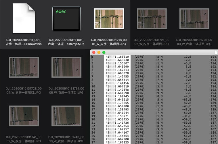
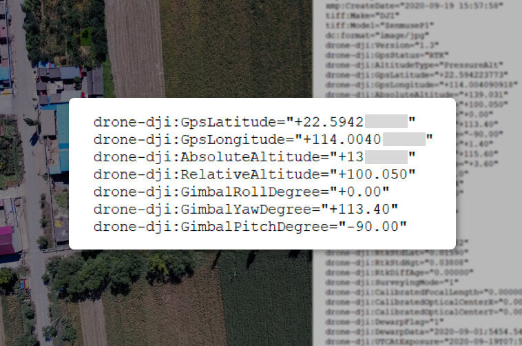
Fieldwork Report
Verify data quality immediately post-flight by checking the position data and number of the images acquired, as well as RTK status and positioning accuracy.
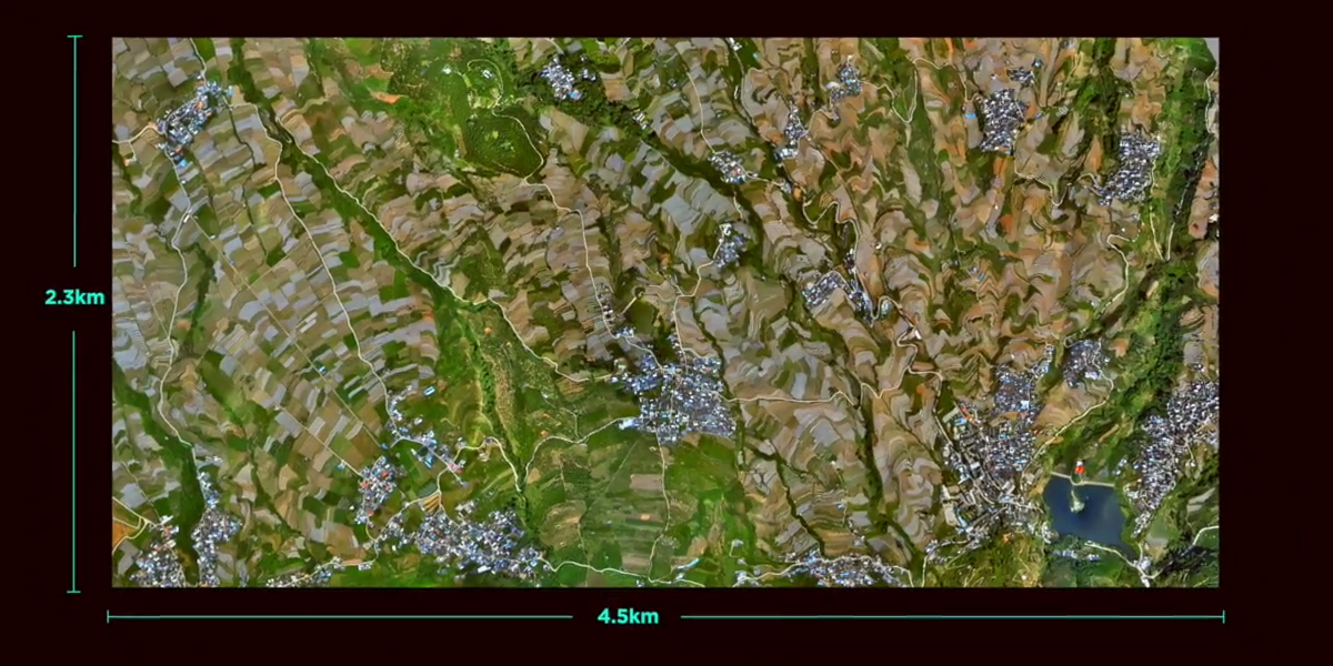
2D Orthomosaic Mission
Generate orthomosaics without GCPs using the P1, perfect for medium to large-area operations.
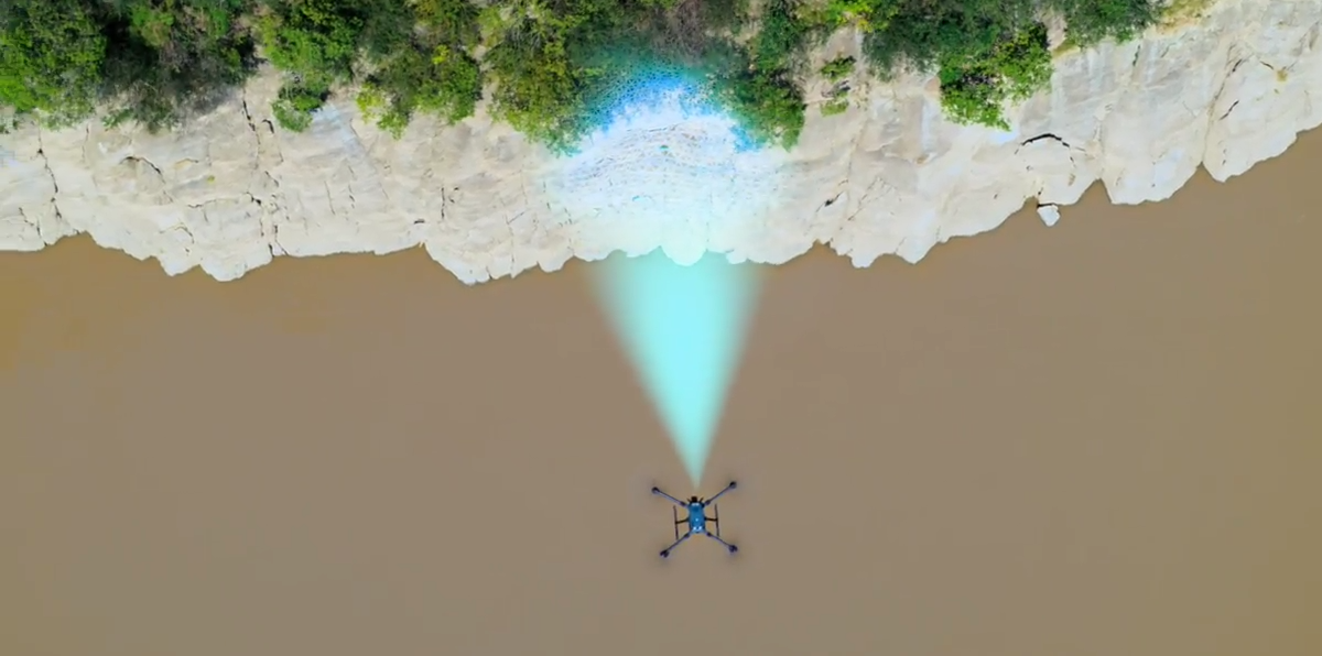
3D Oblique Mission
Effortlessly acquire oblique images from multiple angles that meet 3D modeling requirements across industries such as urban planning and centimeter-level accurate cadastral surveys to serve 3D reality models and smart city planning.
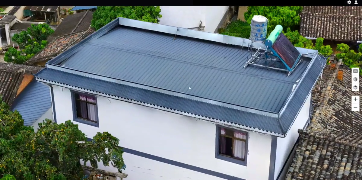
Detailed Modeling Mission
Acquire ultra-high resolution image data of vertical or slanted surfaces from a safe distance that faithfully recreates fine textures, structures, and features, for detailed reconstructions, geological surveys, heritage site conservation, hydraulic engineering, and more.
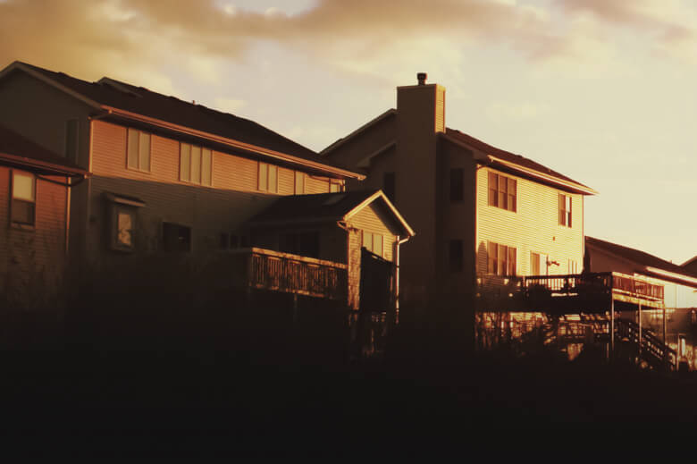
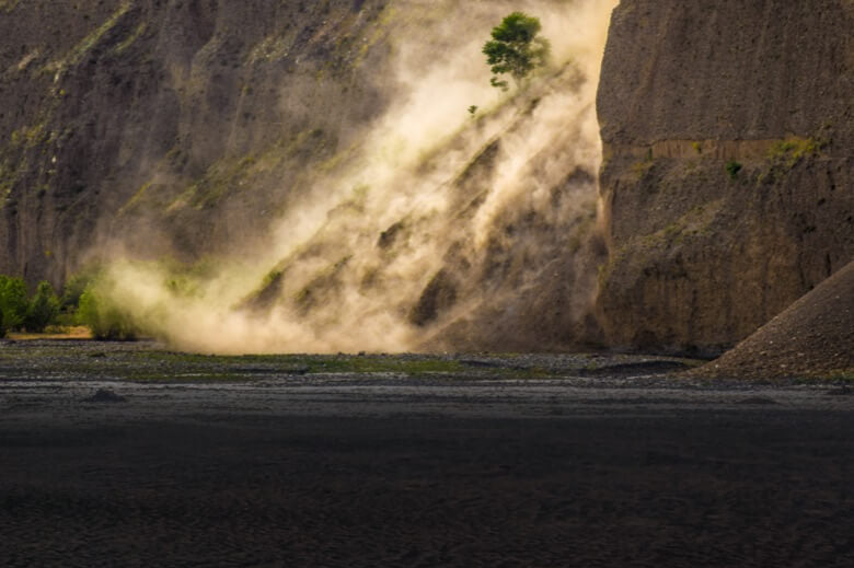
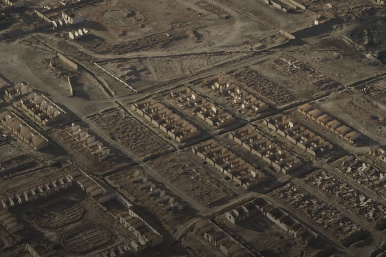
Application Scenarios


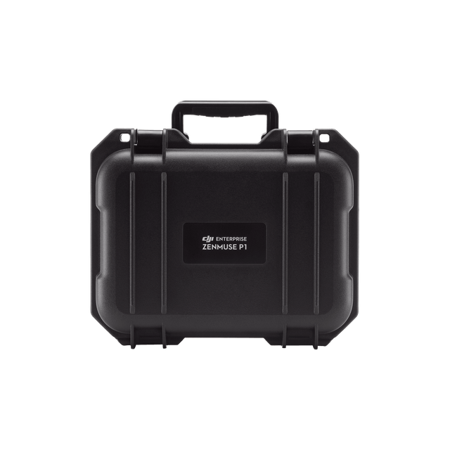
What’s Included
Specifications
| General | |
|---|---|
|
Dimensions
|
|
|
Weight
|
|
|
Power
|
|
|
IP Rating
|
|
|
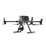
Supported Aircraft
|
|
|
Operating Temperature Range
|
|
|
Storage Temperature Range
|
|
|
Absolute Accuracy
|
|
| Camera | |
|
Sensor
|
|
|
Supported Lenses
|
|
|
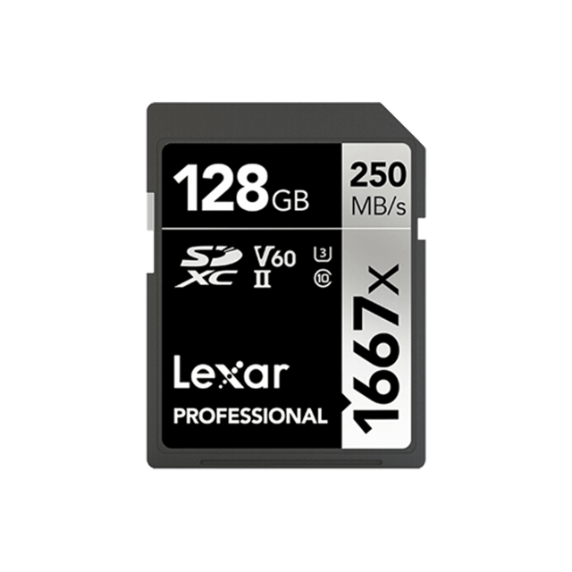
Supported SD Cards
|
|
|
Storage Files
|
|
|
Photo Size
|
|
|
Operation Modes
|
|
|
Minimum Photo Interval
|
|
|
Shutter Speed
|
|
|
Aperture Range
|
|
|
ISO Range
|
|
| Video | |
|
Video Format
|
|
|
Video Resolution
|
|
|
Frame Rate
|
|
| Gimbal | |
|
Stabilised System
|
|
|
Angular Vibration Range
|
|
|
Mount
|
|
|
Mechanical Range
|
|
The New Benchmark for Aerial Surveying
The Zenmuse P1 integrates a full-frame sensor with interchangeable fixed-focus lenses on a 3-axis stabilised gimbal. Designed for photogrammetry flight missions, it takes efficiency and accuracy to a whole new level.
Efficiency to Cover It All
Full-frame Camera
– 45MP Full-frame Sensor
– 4.4μm Pixel Size
– Low-noise, high sensitivity imaging extends daily operational time
– Take a photo every 0.7 s during the flight
– TimeSync 2.0 aligns the camera, flight controller, RTK module, and gimbal at the microsecond level
Flexibility to Capture It All
Multiple Fixed-focus Lens Options
– Global Mechanical Shutter, , Shutter Speed 1/2000 Seconds
– Sends the median exposure pulse in microseconds
– Supports 24/35/50mm lenses with DJI DL mounts
Smart Oblique Capture
Cover 7.5 km2 in a single workday with the P1. Elevate the efficiency of your oblique photography mission using Smart Oblique Capture, where the gimbal automatically rotates to take photos at the different angles needed. Only photos essential to the reconstruction will be taken at the edge of the flight area, increasing the efficiency of post processing by 20% to 50%.
Smart Data Management
Fieldwork Report
Verify data quality immediately post-flight by checking the position data and number of the images acquired, as well as RTK status and positioning accuracy.
2D Orthomosaic Mission
Generate orthomosaics without GCPs using the P1, perfect for medium to large-area operations.
3D Oblique Mission
Effortlessly acquire oblique images from multiple angles that meet 3D modeling requirements across industries such as urban planning and centimeter-level accurate cadastral surveys to serve 3D reality models and smart city planning.
Detailed Modeling Mission
Acquire ultra-high resolution image data of vertical or slanted surfaces from a safe distance that faithfully recreates fine textures, structures, and features, for detailed reconstructions, geological surveys, heritage site conservation, hydraulic engineering, and more.
Application Scenarios
What’s Included
Specifications
| General | |
|---|---|
|
Dimensions
|
|
|
Weight
|
|
|
Power
|
|
|
IP Rating
|
|
|
Supported Aircraft
|
|
|
Operating Temperature Range
|
|
|
Storage Temperature Range
|
|
|
Absolute Accuracy
|
|
| Camera | |
|
Sensor
|
|
|
Supported Lenses
|
|
|
Supported SD Cards
|
|
|
Storage Files
|
|
|
Photo Size
|
|
|
Operation Modes
|
|
|
Minimum Photo Interval
|
|
|
Shutter Speed
|
|
|
Aperture Range
|
|
|
ISO Range
|
|
| Video | |
|
Video Format
|
|
|
Video Resolution
|
|
|
Frame Rate
|
|
| Gimbal | |
|
Stabilised System
|
|
|
Angular Vibration Range
|
|
|
Mount
|
|
|
Mechanical Range
|
|
Reviews
Clear filtersThere are no reviews yet.