


")


Delivery Time
Inside Dhaka: From next day to 1 business days.
*Inside Dhaka North and South City Corporation.
Outside Dhaka: From next day to 3 business days.
**Home Delivery/Courier Delivery.
Shipping Charge
Inside Dhaka: Starts from 100Tk.
**Inside Dhaka North and South City Corporation.
Outside Dhaka: Starts from 200Tk.
**Home Delivery/Courier Delivery.

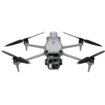
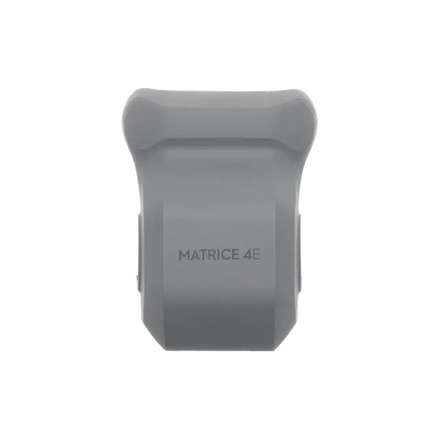
DJI Matrice 4E RTK
Overview
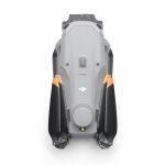
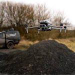
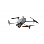
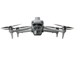
The DJI Matrice 4E is part of DJI’s latest enterprise drone lineup, designed for surveying, mapping, and industrial inspections. The “E” version emphasizes high-precision geospatial applications with RTK support for centimeter-level accuracy. Compact, reliable, and feature-rich, it’s an excellent tool for professionals in mapping, construction, agriculture, and public safety.
Key Specifications & Features
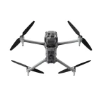
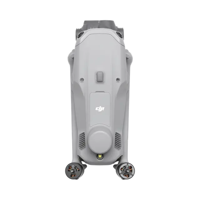
Aircraft / Physical
- Takeoff weight: ~1,219 g (standard props) / ~1,229 g (low-noise props)
- Maximum takeoff weight: ~1,420 g (standard) / ~1,430 g (low-noise)
- Folded size: ~260 × 114 × 138 mm
- Unfolded size: ~307 × 388 × 150 mm
- Maximum payload: ~200 g
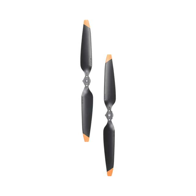
- Propeller options: Standard and low-noise
Flight Performance
- Maximum speed: ~21 m/s
- Max ascent: ~10 m/s
- Max descent: ~8 m/s
- Flight time: ~42 minutes (standard props) / ~39 minutes (low-noise)
- Operating temperature: –10 °C to +40 °C
- Strong wind resistance for industrial missions
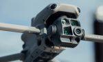
Imaging System
- Wide-Angle Camera: 4/3 CMOS, 20 MP, f/2.8–f/11, mechanical shutter
- Medium Tele Camera: 1/1.3″ CMOS, 48 MP, f/2.8, ~70 mm focal length
- Telephoto Camera: 1/1.5″ CMOS, 48 MP, f/2.8, ~168 mm focal length
- Laser Rangefinder: Range up to 1,800 m; accuracy ± (0.2 + 0.0015 × distance) m
- Obstacle Sensing: Omnidirectional binocular vision + bottom infrared sensors, effective up to 200 m, safe operation at speeds up to 21 m/s
Positioning & RTK
- Centimeter-level accuracy with RTK positioning
- Horizontal accuracy: ~1 cm + 1 ppm
- Vertical accuracy: ~1.5 cm + 1 ppm
- Supports custom RTK networks, NTRIP connections, and base station setups
Survey & Mapping Features
- 0.5-second interval shooting for efficient surveys
- Supports orthophoto and oblique mapping
- Distortion correction to <2 pixels for accurate photogrammetry
- Smart 3D capture for automated modeling routes
- Mapping software shows “observed area” to avoid coverage gaps
Transmission & Connectivity
- O4 Enterprise transmission system with stable long-range connectivity
- High data download rates up to 20 MB/s in optimal conditions
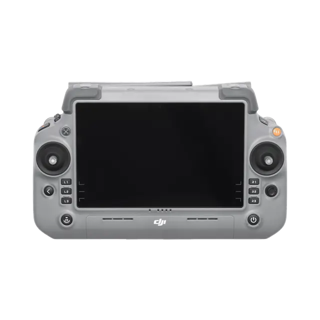
- RC Plus 2 Enterprise controller with support for cellular dongles and network RTK
Other Features
- AI detection of vehicles, vessels, and people for inspections and safety missions
- Night Scene Mode for low-light operations
- Built-in beacon for aircraft location
- Multiple accessory options (speaker, spotlight, etc.)
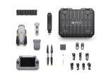
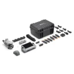
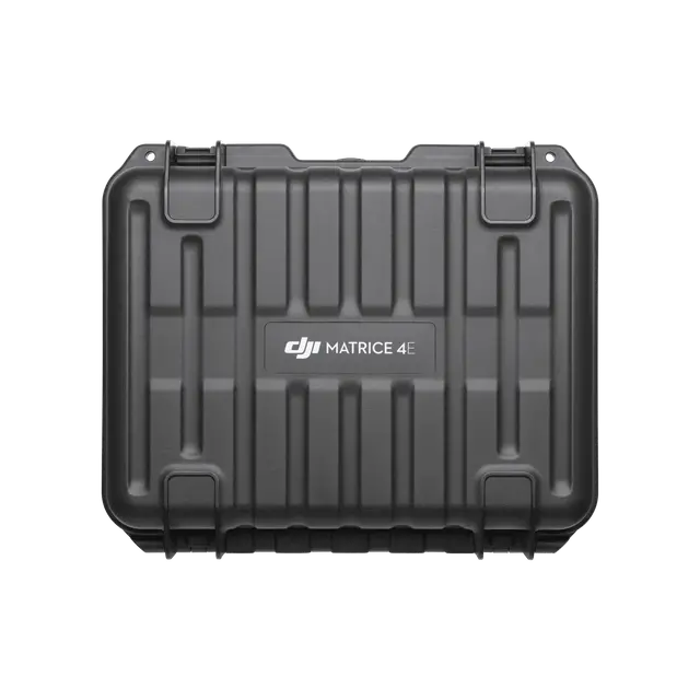
In the Box
- Matrice 4E aircraft
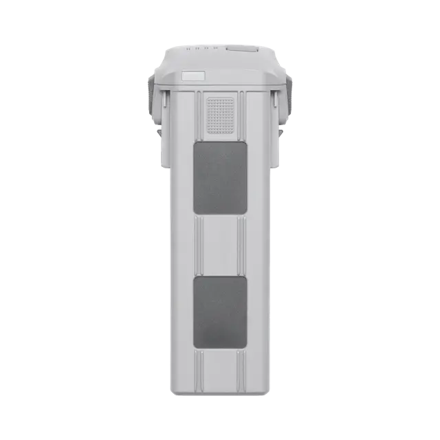
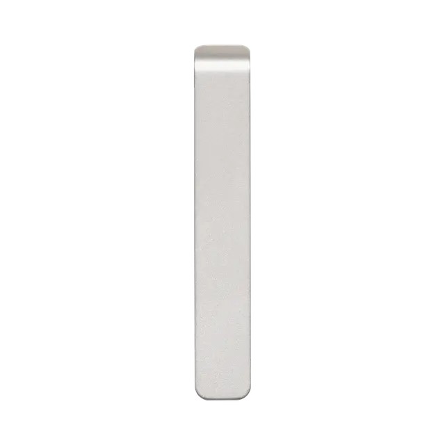
- Intelligent flight battery
- RC Plus 2 Enterprise controller
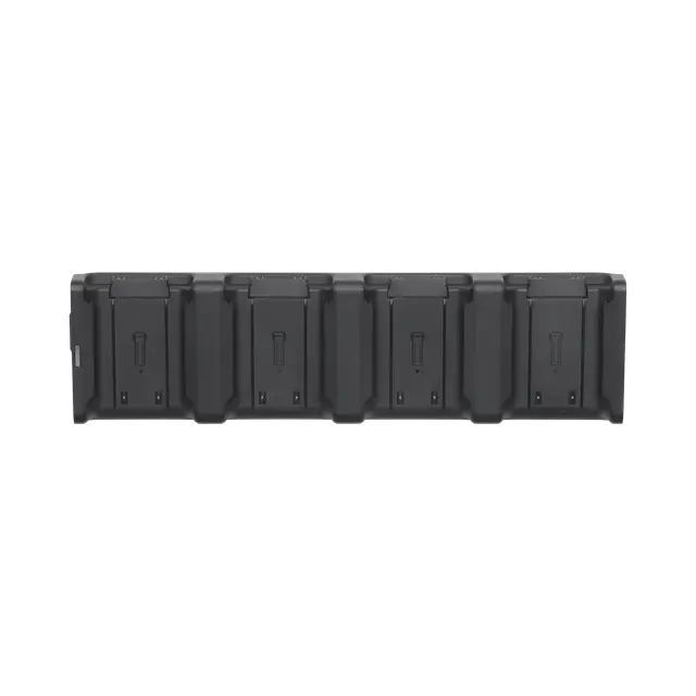
- Charger and charging hub
- Propeller pairs (3 sets)
- Gimbal protector
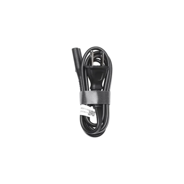
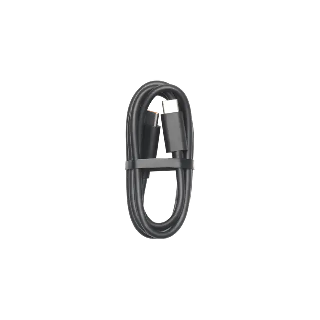
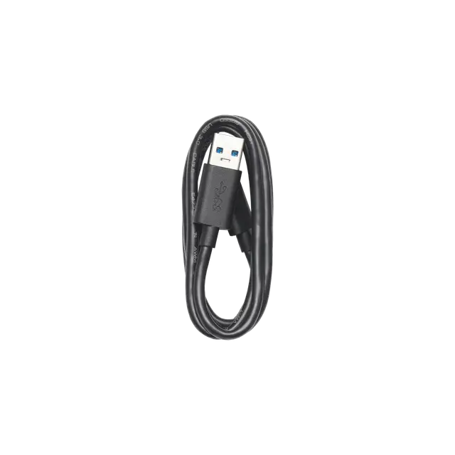
- USB-C power adapter and cables
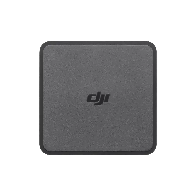
- Cellular dongle for RTK/network use
Strengths
- High-precision mapping with RTK integration
- Excellent imaging with tri-camera system and laser rangefinder
- Compact, portable design for professional use
- Strong obstacle sensing and AI detection features
- Long endurance with ~42 minutes of flight time
Considerations
- Limited payload capacity (~200 g)
- RTK fix can be harder in dense urban or forested areas
- Sensitive to Bangladesh’s hot, humid, and dusty conditions—requires frequent maintenance
- Spare parts and enterprise-level support may have higher costs
- Weather limitations during monsoon and high winds
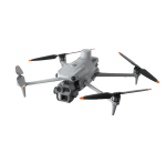
Introducing the DJI Matrice 4 Series, a new compact and intelligent multi-sensor flagship drone series for enterprise industries. The series includes Matrice 4T and Matrice 4E, each equipped with advanced features such as smart detection and measurement with laser range finder. Flight operations are now safer, more reliable, and powered by AI, with significantly enhanced sensing capabilities. The accessories for the Matrice 4 series have also been significantly upgraded. The Matrice 4T is suitable for a wide range of industries, including electricity, emergency response, public safety, and forestry conservation. The Matrice 4E is designed for geospatial applications such as surveying and mapping, construction, and mining. A new era in intelligent aerial operations begins now.
Two Models, Countless Applications
Wide-Angle Camera
1/1.3″ CMOS, 48MP Effective Pixels, f/1.7, Format Equivalent: 24 mm
Medium Tele Camera
1/1.3″ CMOS, 48MP Effective Pixels, f/2.8, Format Equivalent: 70 mm
Tele Camera
1/1.5″ CMOS, 48MP Effective Pixels, f/2.8, Format Equivalent: 168 mm
Laser Range Finder
Measurement Range: 1800 m (1 Hz); Oblique Incidence Range (1:5 Oblique Distance): 600 m (1 Hz) Blind Zone: 1 m; Range Accuracy (m): ± (0.2 + 0.0015 × D)
Infrared Thermal Camera
Resolution 640 × 512, f/1.0, Equivalent Focal Length: 53 mm, Uncooled VOx Microbolometer, Supports High-Res Mode
NIR Auxiliary Light
FOV: 6°, Illumination Distance: 100 m
Intelligent Operations With AI
AI Power for Smarter Operations
The built-in AI model can detect vehicles, vessels, and subjects during search and rescue operations or routine flights. It also supports switching to other models, enabling the expansion of AI application scenarios. Additionally, it supports high-res grid photos and features powerful tracking capabilities.
Laser Range Finder, Precise Measurement
The laser range finder enables real-time precise measurement. Through simple operations such as pin point, line drawing, and area calculation, it can complete tasks like marking target locations for inspection purposes or calculating the area of a wildfire. Additionally, users can share info via the DJI Pilot QR code or FlightHub 2 with relevant personnel to enhance collaboration and workflow efficiency.

Observation Range Recording
DJI Pilot 2 can highlight the center position of the camera frame and ground area observed. It can display the surveyed area on the map, making it especially useful for patrols, and rescue operations in mountainous terrain without clear landmarks.

Efficient Flight, Intelligent Operations
Activate cruise control mode to pilot the drone in a specific direction without constantly pressing the control sticks, making long-distance flights easier.

Excel In Low-Light Environments
Night Scene Mode
The Matrice 4 series has received a significant night mode upgrade. Its Full-Color night vision now supports three modes and includes two levels of enhanced noise reduction. Equipped with an IR Cut Filter and NIR auxiliary light, it effortlessly overcomes the challenges of darkness, ensuring search and rescue subjects clearly visible.

Smart Low-Light Photo
The Matrice 4 series cameras feature larger apertures and intelligent low-light capabilities, significantly enhancing performance and improving operations during dusk and nighttime.

NIR Auxiliary Light
The Matrice 4T features new NIR illumination hardware, enabling lighting distances of up to 100 meters. This ensures clear visibility of objects in dark environments, making it ideal for applications like wildlife protection.

Thermal Imaging
The Matrice 4T supports infrared High-Res Mode, with image resolutions up to 1280 × 1024. It also offers Ultra-High Resolution, revealing small temperature details for various operations. Each device undergoes temperature accuracy calibration and utilizes an onboard temperature sensor to provide real-time temperature measurements.

Low-Light Fisheye Omnidirectional Sensing
The Matrice 4 series has six high-definition low-light fisheye vision sensors, significantly enhancing visual low-light positioning and obstacle avoidance capabilities. This allows for automatic obstacle avoidance, intelligent rerouting, and safe return in urban low-light environments.

Crystal Clear Vision: Unveil the Details
Capture Every Detail at A Distance
Enhanced Medium Telephoto
The Matrice 4 series is equipped with a medium tele camera, expanding its capabilities for medium-range inspection tasks. During power line or bridge inspections, it can detect screws and cracks from a distance of 10 meters and clearly read instrument data at substations.

Super Resolution Telephoto
The tele camera of the Matrice 4 series has significantly improved clarity, featuring 48 MP resolution, capable of capturing incredibly details from signs up to 250 meters away. [Additionally, the Matrice 4T is equipped with an IR-Cut Filter, ensuring 24/7 operations.

Foreground Stabilization for Telephoto Imagery
The upgraded telephoto stabilization makes foreground subjects stable and clear during telephoto shooting at 10x zoom or higher. In scenarios such as public safety and inspections, subject details are clearly visible.

Electronic Dehazing, Clear as Ever
In conditions such as smog or atmospheric humidity, Electronic Dehazing supports three modes (Low, Medium, High) to improve the imaging clarity of the Matrice 4 series to match different operational environments and requirements.

Precision Mapping, Time-Saving and Effortless
Rapid 0.5-Second Interval Shooting
The Matrice 4E wide-angle camera supports rapid 0.5-second interval shooting in both orthophoto and oblique photography modes, enabling high-speed aerial surveying from multiple angles. Additionally, the mapping flight speed can reach up to 21 meters per second, significantly enhancing work efficiency.

5-Directional Oblique Capture
The Matrice 4 series supports a new 5-directional oblique capture. The gimbal can intelligently rotate and shoot at multiple angles based on the survey area, achieving the effect of multiple shots in a single flight compared to previous models, significantly enhancing the efficiency of small drone oblique photography.

3-Directional Ortho Capture
Matrice 4E supports 3-directional ortho capture, enabling lateral capturing while performing ortho collection tasks, which reduces lateral overlap. A single flight can complete mapping operations for an area of 2.8 square kilometers. No additional elevation optimization flight route is required to achieve better elevation accuracy. Combined with new DJI Terra capabilities, it further enhances reconstruction efficiency while ensuring quality.

Smart 3D Capture, Precision Modeling
DJI Matrice 4E supports Smart 3D Capture, which allows you to capture and create a rough model on the remote controller. Based on the rough model, it can quickly generate precise mapping routes close to a structures surface, completing detailed measurements and modeling of irregular buildings. It also supports displaying virtual space routes and waypoint photos for smart 3D capture, making it convenient to assess specific routes’ flight safety and coverage area.
Distortion Correction, Precision Enhancement
Distortion Correction 2.0 provides high-precision in-camera distortion correction with residual distortion less than 2 pixels. Each Matrice 4E’s wide-angle camera is calibrated before leaving the factory, when used with DJI Terra, it significantly improves reconstruction accuracy.

Auto-Generated Surveying operation Report
Upon completion of an operation, DJI Pilot 2 can automatically generate a survey quality report. This report provides comprehensive access to key information such as photo points, RTK status, and photo parameters. If there are any anomalies, additional photos can be taken on-site to avoid repeated trips.

Safe Flight, Worry-Free Operation
Fusion Positioning, Safe Return-to-Home
The Matrice 4 series comes with an integrated DJI RTK module which supports the extended L5 frequency band and features GNSS+Vision Fusion Positioning and Navigation System. It allows for the return-to-home point to be updated through visual positioning, allowing for rapid takeoff within 15 seconds. Even without GNSS signals, it can complete the return-to-home process, effectively overcoming signal obstructions and interference commonly found in urban environments.

Intelligent Guidance, Unobstructed Flight
When the DJI RC Plus 2 Enterprise remote controller is connected to the internet, it can load terrain elevation maps and preload detailed maps. This enables automatic path planning for obstacle avoidance, effectively managing scenarios such as flying at night or through mountainous areas, ensuring the safety of flight operations. The drone has a 5-directional vision assist view system along with downward vision, which aids in providing comprehensive visibility for enhanced protection.

Achieve New Heights in Video Transmission
The O4 Enterprise video transmission system sets a new industry standard for challenging environments. Thanks to the 8-antenna system in the Matrice 4 Series and the high-gain antenna in the remote controller, you can achieve up to 25 kilometers in transmission range. Furthermore, the system improves image transmission with a download bandwidth of 20MB/s, more than double the bitrate of the Mavic 3 Enterprise Series, ensuring more precise and stable images of route uploads and material downloads.
The Matrice 4 series supports an optional DJI Cellular Dongle 2. By utilizing 4G image transmission in conjunction with the aircraft’s antennas, signal stability is further enhanced.

What’s Included
Practical Tips for Bangladesh Use
- Use a reliable RTK base station or NTRIP service for full accuracy
- Clean sensors and lenses regularly to handle dust and humidity
- Monitor batteries in hot weather to avoid reduced performance
- Plan flights carefully during monsoon or high winds
- Always check CAAB (Bangladesh Civil Aviation) regulations before operations
The DJI Matrice 4E RTK is the latest enterprise drone designed for professional mapping, surveying, and inspection tasks. Built with precision and efficiency in mind, this compact powerhouse delivers centimeter-level accuracy through advanced RTK positioning. With a tri-camera system—20MP wide-angle, 48MP medium tele, and 48MP telephoto—plus a high-precision laser rangefinder, the Matrice 4E captures detailed imagery from any angle, making it ideal for construction, land surveying, agriculture, and infrastructure projects.
Equipped with omnidirectional obstacle sensing, AI-powered detection, and a flight time of up to 42 minutes, the Matrice 4E ensures safe and reliable missions even in complex environments. Its distortion correction technology and rapid 0.5-second shooting interval allow for seamless orthophoto and 3D mapping with superior accuracy.
For businesses in Bangladesh, the DJI Matrice 4E RTK offers unmatched efficiency and reliability. Whether you are conducting cadastral surveys, inspection work, or industrial monitoring, this drone is engineered to deliver professional-grade results while saving time and resources. Available now at Drone Fly BD—your trusted source for DJI enterprise drones in Bangladesh.
DJI Matrice 4E RTK
Overview
The DJI Matrice 4E is part of DJI’s latest enterprise drone lineup, designed for surveying, mapping, and industrial inspections. The “E” version emphasizes high-precision geospatial applications with RTK support for centimeter-level accuracy. Compact, reliable, and feature-rich, it’s an excellent tool for professionals in mapping, construction, agriculture, and public safety.
Key Specifications & Features
Aircraft / Physical
- Takeoff weight: ~1,219 g (standard props) / ~1,229 g (low-noise props)
- Maximum takeoff weight: ~1,420 g (standard) / ~1,430 g (low-noise)
- Folded size: ~260 × 114 × 138 mm
- Unfolded size: ~307 × 388 × 150 mm
- Maximum payload: ~200 g
- Propeller options: Standard and low-noise
Flight Performance
- Maximum speed: ~21 m/s
- Max ascent: ~10 m/s
- Max descent: ~8 m/s
- Flight time: ~42 minutes (standard props) / ~39 minutes (low-noise)
- Operating temperature: –10 °C to +40 °C
- Strong wind resistance for industrial missions
Imaging System
- Wide-Angle Camera: 4/3 CMOS, 20 MP, f/2.8–f/11, mechanical shutter
- Medium Tele Camera: 1/1.3″ CMOS, 48 MP, f/2.8, ~70 mm focal length
- Telephoto Camera: 1/1.5″ CMOS, 48 MP, f/2.8, ~168 mm focal length
- Laser Rangefinder: Range up to 1,800 m; accuracy ± (0.2 + 0.0015 × distance) m
- Obstacle Sensing: Omnidirectional binocular vision + bottom infrared sensors, effective up to 200 m, safe operation at speeds up to 21 m/s
Positioning & RTK
- Centimeter-level accuracy with RTK positioning
- Horizontal accuracy: ~1 cm + 1 ppm
- Vertical accuracy: ~1.5 cm + 1 ppm
- Supports custom RTK networks, NTRIP connections, and base station setups
Survey & Mapping Features
- 0.5-second interval shooting for efficient surveys
- Supports orthophoto and oblique mapping
- Distortion correction to <2 pixels for accurate photogrammetry
- Smart 3D capture for automated modeling routes
- Mapping software shows “observed area” to avoid coverage gaps
Transmission & Connectivity
- O4 Enterprise transmission system with stable long-range connectivity
- High data download rates up to 20 MB/s in optimal conditions
- RC Plus 2 Enterprise controller with support for cellular dongles and network RTK
Other Features
- AI detection of vehicles, vessels, and people for inspections and safety missions
- Night Scene Mode for low-light operations
- Built-in beacon for aircraft location
- Multiple accessory options (speaker, spotlight, etc.)
In the Box
- Matrice 4E aircraft
- Intelligent flight battery
- RC Plus 2 Enterprise controller
- Charger and charging hub
- Propeller pairs (3 sets)
- Gimbal protector
- USB-C power adapter and cables
- Cellular dongle for RTK/network use
Strengths
- High-precision mapping with RTK integration
- Excellent imaging with tri-camera system and laser rangefinder
- Compact, portable design for professional use
- Strong obstacle sensing and AI detection features
- Long endurance with ~42 minutes of flight time
Considerations
- Limited payload capacity (~200 g)
- RTK fix can be harder in dense urban or forested areas
- Sensitive to Bangladesh’s hot, humid, and dusty conditions—requires frequent maintenance
- Spare parts and enterprise-level support may have higher costs
- Weather limitations during monsoon and high winds
Introducing the DJI Matrice 4 Series, a new compact and intelligent multi-sensor flagship drone series for enterprise industries. The series includes Matrice 4T and Matrice 4E, each equipped with advanced features such as smart detection and measurement with laser range finder. Flight operations are now safer, more reliable, and powered by AI, with significantly enhanced sensing capabilities. The accessories for the Matrice 4 series have also been significantly upgraded. The Matrice 4T is suitable for a wide range of industries, including electricity, emergency response, public safety, and forestry conservation. The Matrice 4E is designed for geospatial applications such as surveying and mapping, construction, and mining. A new era in intelligent aerial operations begins now.
Two Models, Countless Applications
Wide-Angle Camera
1/1.3″ CMOS, 48MP Effective Pixels, f/1.7, Format Equivalent: 24 mm
Medium Tele Camera
1/1.3″ CMOS, 48MP Effective Pixels, f/2.8, Format Equivalent: 70 mm
Tele Camera
1/1.5″ CMOS, 48MP Effective Pixels, f/2.8, Format Equivalent: 168 mm
Laser Range Finder
Measurement Range: 1800 m (1 Hz); Oblique Incidence Range (1:5 Oblique Distance): 600 m (1 Hz) Blind Zone: 1 m; Range Accuracy (m): ± (0.2 + 0.0015 × D)
Infrared Thermal Camera
Resolution 640 × 512, f/1.0, Equivalent Focal Length: 53 mm, Uncooled VOx Microbolometer, Supports High-Res Mode
NIR Auxiliary Light
FOV: 6°, Illumination Distance: 100 m
Intelligent Operations With AI
AI Power for Smarter Operations
The built-in AI model can detect vehicles, vessels, and subjects during search and rescue operations or routine flights. It also supports switching to other models, enabling the expansion of AI application scenarios. Additionally, it supports high-res grid photos and features powerful tracking capabilities.
Laser Range Finder, Precise Measurement
The laser range finder enables real-time precise measurement. Through simple operations such as pin point, line drawing, and area calculation, it can complete tasks like marking target locations for inspection purposes or calculating the area of a wildfire. Additionally, users can share info via the DJI Pilot QR code or FlightHub 2 with relevant personnel to enhance collaboration and workflow efficiency.
Observation Range Recording
DJI Pilot 2 can highlight the center position of the camera frame and ground area observed. It can display the surveyed area on the map, making it especially useful for patrols, and rescue operations in mountainous terrain without clear landmarks.
Efficient Flight, Intelligent Operations
Activate cruise control mode to pilot the drone in a specific direction without constantly pressing the control sticks, making long-distance flights easier.
Excel In Low-Light Environments
Night Scene Mode
The Matrice 4 series has received a significant night mode upgrade. Its Full-Color night vision now supports three modes and includes two levels of enhanced noise reduction. Equipped with an IR Cut Filter and NIR auxiliary light, it effortlessly overcomes the challenges of darkness, ensuring search and rescue subjects clearly visible.
Smart Low-Light Photo
The Matrice 4 series cameras feature larger apertures and intelligent low-light capabilities, significantly enhancing performance and improving operations during dusk and nighttime.
NIR Auxiliary Light
The Matrice 4T features new NIR illumination hardware, enabling lighting distances of up to 100 meters. This ensures clear visibility of objects in dark environments, making it ideal for applications like wildlife protection.
Thermal Imaging
The Matrice 4T supports infrared High-Res Mode, with image resolutions up to 1280 × 1024. It also offers Ultra-High Resolution, revealing small temperature details for various operations. Each device undergoes temperature accuracy calibration and utilizes an onboard temperature sensor to provide real-time temperature measurements.
Low-Light Fisheye Omnidirectional Sensing
The Matrice 4 series has six high-definition low-light fisheye vision sensors, significantly enhancing visual low-light positioning and obstacle avoidance capabilities. This allows for automatic obstacle avoidance, intelligent rerouting, and safe return in urban low-light environments.
Crystal Clear Vision: Unveil the Details
Capture Every Detail at A Distance
Enhanced Medium Telephoto
The Matrice 4 series is equipped with a medium tele camera, expanding its capabilities for medium-range inspection tasks. During power line or bridge inspections, it can detect screws and cracks from a distance of 10 meters and clearly read instrument data at substations.
Super Resolution Telephoto
The tele camera of the Matrice 4 series has significantly improved clarity, featuring 48 MP resolution, capable of capturing incredibly details from signs up to 250 meters away. [Additionally, the Matrice 4T is equipped with an IR-Cut Filter, ensuring 24/7 operations.
Foreground Stabilization for Telephoto Imagery
The upgraded telephoto stabilization makes foreground subjects stable and clear during telephoto shooting at 10x zoom or higher. In scenarios such as public safety and inspections, subject details are clearly visible.
Electronic Dehazing, Clear as Ever
In conditions such as smog or atmospheric humidity, Electronic Dehazing supports three modes (Low, Medium, High) to improve the imaging clarity of the Matrice 4 series to match different operational environments and requirements.
Precision Mapping, Time-Saving and Effortless
Rapid 0.5-Second Interval Shooting
The Matrice 4E wide-angle camera supports rapid 0.5-second interval shooting in both orthophoto and oblique photography modes, enabling high-speed aerial surveying from multiple angles. Additionally, the mapping flight speed can reach up to 21 meters per second, significantly enhancing work efficiency.
5-Directional Oblique Capture
The Matrice 4 series supports a new 5-directional oblique capture. The gimbal can intelligently rotate and shoot at multiple angles based on the survey area, achieving the effect of multiple shots in a single flight compared to previous models, significantly enhancing the efficiency of small drone oblique photography.
3-Directional Ortho Capture
Matrice 4E supports 3-directional ortho capture, enabling lateral capturing while performing ortho collection tasks, which reduces lateral overlap. A single flight can complete mapping operations for an area of 2.8 square kilometers. No additional elevation optimization flight route is required to achieve better elevation accuracy. Combined with new DJI Terra capabilities, it further enhances reconstruction efficiency while ensuring quality.
Smart 3D Capture, Precision Modeling
DJI Matrice 4E supports Smart 3D Capture, which allows you to capture and create a rough model on the remote controller. Based on the rough model, it can quickly generate precise mapping routes close to a structures surface, completing detailed measurements and modeling of irregular buildings. It also supports displaying virtual space routes and waypoint photos for smart 3D capture, making it convenient to assess specific routes’ flight safety and coverage area.
Distortion Correction, Precision Enhancement
Distortion Correction 2.0 provides high-precision in-camera distortion correction with residual distortion less than 2 pixels. Each Matrice 4E’s wide-angle camera is calibrated before leaving the factory, when used with DJI Terra, it significantly improves reconstruction accuracy.
Auto-Generated Surveying operation Report
Upon completion of an operation, DJI Pilot 2 can automatically generate a survey quality report. This report provides comprehensive access to key information such as photo points, RTK status, and photo parameters. If there are any anomalies, additional photos can be taken on-site to avoid repeated trips.
Safe Flight, Worry-Free Operation
Fusion Positioning, Safe Return-to-Home
The Matrice 4 series comes with an integrated DJI RTK module which supports the extended L5 frequency band and features GNSS+Vision Fusion Positioning and Navigation System. It allows for the return-to-home point to be updated through visual positioning, allowing for rapid takeoff within 15 seconds. Even without GNSS signals, it can complete the return-to-home process, effectively overcoming signal obstructions and interference commonly found in urban environments.
Intelligent Guidance, Unobstructed Flight
When the DJI RC Plus 2 Enterprise remote controller is connected to the internet, it can load terrain elevation maps and preload detailed maps. This enables automatic path planning for obstacle avoidance, effectively managing scenarios such as flying at night or through mountainous areas, ensuring the safety of flight operations. The drone has a 5-directional vision assist view system along with downward vision, which aids in providing comprehensive visibility for enhanced protection.
Achieve New Heights in Video Transmission
The O4 Enterprise video transmission system sets a new industry standard for challenging environments. Thanks to the 8-antenna system in the Matrice 4 Series and the high-gain antenna in the remote controller, you can achieve up to 25 kilometers in transmission range. Furthermore, the system improves image transmission with a download bandwidth of 20MB/s, more than double the bitrate of the Mavic 3 Enterprise Series, ensuring more precise and stable images of route uploads and material downloads.
The Matrice 4 series supports an optional DJI Cellular Dongle 2. By utilizing 4G image transmission in conjunction with the aircraft’s antennas, signal stability is further enhanced.
What’s Included
Practical Tips for Bangladesh Use
- Use a reliable RTK base station or NTRIP service for full accuracy
- Clean sensors and lenses regularly to handle dust and humidity
- Monitor batteries in hot weather to avoid reduced performance
- Plan flights carefully during monsoon or high winds
- Always check CAAB (Bangladesh Civil Aviation) regulations before operations
The DJI Matrice 4E RTK is the latest enterprise drone designed for professional mapping, surveying, and inspection tasks. Built with precision and efficiency in mind, this compact powerhouse delivers centimeter-level accuracy through advanced RTK positioning. With a tri-camera system—20MP wide-angle, 48MP medium tele, and 48MP telephoto—plus a high-precision laser rangefinder, the Matrice 4E captures detailed imagery from any angle, making it ideal for construction, land surveying, agriculture, and infrastructure projects.
Equipped with omnidirectional obstacle sensing, AI-powered detection, and a flight time of up to 42 minutes, the Matrice 4E ensures safe and reliable missions even in complex environments. Its distortion correction technology and rapid 0.5-second shooting interval allow for seamless orthophoto and 3D mapping with superior accuracy.
For businesses in Bangladesh, the DJI Matrice 4E RTK offers unmatched efficiency and reliability. Whether you are conducting cadastral surveys, inspection work, or industrial monitoring, this drone is engineered to deliver professional-grade results while saving time and resources. Available now at Drone Fly BD—your trusted source for DJI enterprise drones in Bangladesh.
Reviews
Clear filtersThere are no reviews yet.